


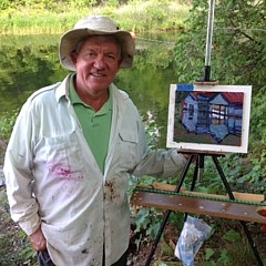
Killbear Light
by Phil Chadwick


Buy the Original Painting
Price
Not Specified
Dimensions
10.000 x 8.000 x 0.625 inches
This original painting is currently for sale. At the present time, originals are not offered for sale through the Phil Chadwick - Website secure checkout system. Please contact the artist directly to inquire about purchasing this original.
Click here to contact the artist.
Title
Killbear Light
Artist
Phil Chadwick
Medium
Painting - Oil On Canvas
Description
This is Killbear Light. The Killbear Lighthouse is not actually part of Killbear Provincial Park. It sits on a 3.5 acre parcel of land owned by the Coast Guard. The first light was built in 1904 to help guide the grain ships, iron ore carriers, passenger ships and logging vessels into Parry Sound and Depot Harbour. The base of the light was a large acetylene gas canister that would be filled every spring and would last the shipping season. Filling the large acetylene canister was a risky business and in the spring of 1908 the Department of Transport ship "Pilot" tied up alongside the buoy at Ten Mile Point near Cameron Island (which is just to the southwest of Killbear, about 3 km from the Park). Seven crew members were on board when an explosion sunk the ship, killed the captain and blew some crew members into the icy April waters. The survivors rowed towards Parry Sound and they spent the night at Pratt's Dance Pavilion on Mowatt Island. After another explosion at the acetylene plant in Parry Sound killed two men the fuel was switched to using smaller tanks like welders use. In 1966 the lighthouse was changed to electricity and in 1994 the original light was replaced with this present structure.
Killbear Provincial Park sits on a peninsula which has been called Killbear Point since the 1850's. Stories have been told about a logger killing a bear or vice versa on that point. Logging was not active in the area until 1860 and lasting until 1920 so that story could well be fiction. Meanwhile the local Anishinabek (Ojibway) people had called the peninsula Mukwa Nayoshing which translates into 'Bear Point' long before there were any loggers in the area. The Ojibway probably called the point Mukwa Nayoshing to recognize the natural corridor for the bears that regularly swim back and forth from the tip of the point to Parry Island where the Wasauksing First Nation is located. I have seen some of these bears while I painted. The question remains why it was called Killbear Point instead of just Bear Point. It is probably just a translation error from the Ojibway language.
Whoever painted the name on the rocks of Bear Point misspelled Killbear with only one "L". I saw a beautiful fox snake on this point when I painted there in 2017 - #1999 "Killbear Sheltered Coves" . I had no idea that Killbear Provincial Park was so close to Parry Sound and Parry Island. It was a long and twisty drive to reach Killbear Provincial Park by the roads. It was a short paddle by water from Parry Sound.
Uploaded
February 22nd, 2020
Statistics
Viewed 1,095 Times - Last Visitor from Cambridge, MA on 04/24/2024 at 4:36 PM
Embed
Share
Sales Sheet
Similar Images


Comments (1)

A Hillman
Great description and history...beautiful! Love the colors, light, shapes and reflections...so balanced and also free and spontaneous! l/f
Phil Chadwick replied:
So very kind of you Sunny. I continue to paint up a storm but soon must turn my attention to the walls of our home:>) I so value your insights and support!
Phil Chadwick replied:
And I have fun investigating the back stories as well. It is fun to learn! Thank you :>))
Recently Viewed
